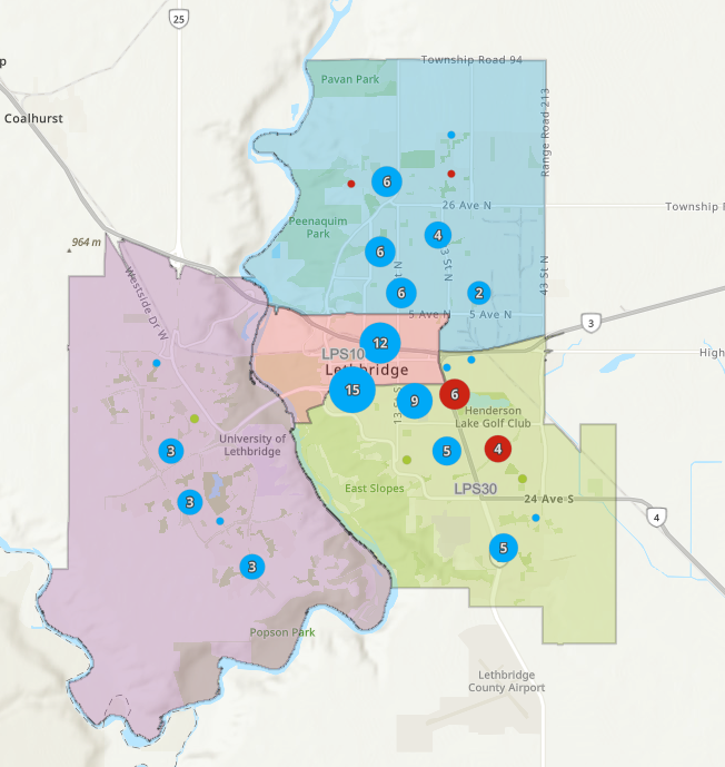
Lethbridge Police have launched an enhanced, interactive crime mapping tool that will aid researchers and others seeking information about crime in the city.
Lethbridge Police Service Open Data is an interactive platform that provides public access to policing activity data, including crime statistics, traffic infractions and other related trends occurring in the city. “The information is shared, as part of our commitment to transparency and to encourage community awareness,” it was stated in a recent media release.
According to the media release, the crime and traffic maps display up to 365 days of select occurrence types with a known location. “To anonymize the location of an incident and protect complainants’ privacy, points on the map are re-located to the nearest intersection. Data is refreshed every 24 hours and searches can be customized.”
Maps are displayed showing the four patrol beats within the city – north, south, downtown and west. In areas with multiple offences in close proximity, the data is displayed as a cluster, indicating the most predominant crime type.
By clicking the “browse” option, a summary list will show each crime and users can further click on each incident to view the occurrence date, reported time, file number, crime category and Uniform Crime Reporting code. There’s also a submit tip function to provide anonymous tips to Crime Stoppers.
For more in-depth inquiries, datasets can be exported in various formats providing researchers with quicker access to data without the need for an access to information request. In the future, LPS also has the ability to add additional map tiles to spotlight various crimes, as part of awareness campaigns or other initiatives.


